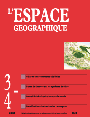

Population growth and land use change: Data, concepts, methods
(2 fig.; 7 photos; 3 tabl.)
As environmental issues become increasingly important in cities, this article documents and examines policies for greening and building green infrastructures in an arid and fast-growing city marked by deep inequalities. Our study, which combines social survey, biogeographic surveys and green network mapping, highlights the contradictions between urban planners’ intentions, inhabitants’ practices and ecological functionalities. The Abu Dhabi example thus proves to be particularly rich for testing this new model of ecological urban planning.
keywords: ARIDITY, GREENING, PUBLIC URBAN SPACE
Deforestation in Northern Benin: Towards a multiplicity of territorial trajectories (15 fig.; 3 tabl.)
The analysis of a time series of satellite images made it possible to characterize various dynamics of deforestation taking place in Northern Benin. They reflect the decades-long adaptation efforts that rural populations have make to face climatic and socioeconomic changes. At the municipal level, different trajectories have been highlighted, taking into account the evolution of woody cover, population growth and transformations in cultivation practices. Finally, the use of Google Earth images showed that the recovery of the woody cover in some villages may have various origins.
keywords: DEFORESTATION, NORTHERN BENIN, REMOTE SENSING, TERRITORIAL TRAJECTORIES
Monitoring an industrial-urban frontier in Ob plain (Russia) using spatial imagery (8 fig.; 1 tabl.)
During the Soviet era, the polar zone of the Ob plain became a vast industrial and urban frontier. However, this co-development between extractive industry and urbanisation is no longer appropriate in today’s Russian market economy. This article contributes to inform how these two functions, industry and habitat, evolved in space during the post-Soviet period. The method used is based on DMSP-OLS night-time imagery with a multi-level approach. The findings show a decoupling of the two functions, the growth of existing urban centres and a higher exposure of populations to industrial risks in the historical areas of the frontier.
keywords: ARCTIC, LAND USE, OB RIVER PLAIN, REMOTE SENSING, RUSSIA
La dispersion urbaine au Brésil, à l’échelle du système de villes et des agglomérations (13 fig.; 1 tabl.)
The Geopolis database allows the comparison of urban agglomerations indicators around the world. Brasipolis uses the Geopolis method for Brazil. With indicators such as population, surface area and density of urban agglomerations, we question the concept of ‘‘urban dispersion’’ as used in Portuguese, Spanish and Italian urban studies to describe ‘‘urban sprawl’’. Urban sprawl in Brazil is not as pronounced as in other countries. Dispersion is manifested by a deconcentration of the population in a dense urban system of medium-sized.
keywords: AGGLOMERATIONS. DECONCENTRATION, POPULATION, URBAN AGGLOMERATION, URBAN DISPERSION, URBAN SYSTEM, URBAN SPRAWL
Urban dispersion in Brazil, analysed at the city system and agglomeration level (2 fig.; 6 photos; 6 tabl.)
The Africapolis regional database, which is derived from the Geopolis database, defines an ‘‘urban’’ agglomeration as a built-up area without more than 200 metres of discontinuity and with a minimum of 10,000 inhabitants. It is a geographical object that can be perceived in the material world. However, some agglomerations have population figures that reach those of large metropolises, and yet they are not accounted for in official national and international statistics. They are unidentified. These UGOs, Unidentified Geographical Objects, are characterised by the densification of the population in regions where traditional habitat was already dense. This article first describes the most remarkable UGOs in terms of size, and then provides explanations on how they emerged.
keywords: CONFINEMENT, DENSITY, POPULATION, URBAN AREA, URBANIZATION
From the refined spatialization of urban data in Africa to unidentified geographical objects (5 fig.; 2 tabl.)
The Africapolis regional database, derived from the Geopolis database, systematically identifies, geolocates and estimates the population of urban areas of over 10,000 inhabitants in Africa. Some of these areas have reached a considerable size without being formally recognized as ‘‘urban’’. Presented in a previous article as Unidentified Geographical Objects (UGOs), this article formalises this notion using the concept of ‘‘foreclosure’’. In psychoanalysis or in law, some thing is said to be foreclosed – literally: locked out – when it has no representation within a symbolic or theoretical field. The article therefore analyses the main factors that could explain the lack of representation of these agglomerations: the construction of official national statistics definitions, the methodology of automatic remote sensing algorithms, the replication of national and international development strategies, and theoretical contradictions with the processes traditionally considered when studying the emergence of urbanisation.
keywords: FORCLOSURBANIZATION, FORCLUSION, POPULATION, URBAN AREA, URBANISATION
Book reviews
In this issue of l’Espace géographique, you will find critical reviews of the following books
GAY J.-C. (2021). La France d’outre-mer. Terres éparses, sociétés vivantes. Paris: Armand Colin, coll. «U», 288 p. (Benoît Antheaume, Ird Paris) ISBN: 978-2-200-62918-2
LAFFONT G.-H., MARTOUZET D. (2021). Ces lieux qui nous affectent. Paris: Hermann, 514 p. (Yves Guermond, université de Rouen) ISBN: 979-10-370-0359-1
ESCACH N., GOFFIN B. (2021). Atlantique. Lyon: Ens Éditions, coll. «Odyssée, villes-portraits», 160 p. (Guy Baudelle, université de Rennes 2) ISBN: 979-10-362-0264-3
L’espace géographique 1-2/21![]()
![]() L’espace géographique 1/22
L’espace géographique 1/22
For subscribe or buy this issue: BELIN
![]() L’Espace géographique: contents
L’Espace géographique: contents
Last modified: March 2, 2023