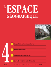

The spread of “theoretical and quantitative” geography in France: Which model of spatial diffusion? (8 fig.; 2 tabl.)
The localization of research centers in theoretical and quantitative geography is highly asymmetrical. This subfield is strongly rooted in France's south-east whereas it is almost nonexistent in outh-western universities. Which spatial diffusion processes produced this configuration? This paper offers an original bias by which to study the spatial diffusion of a scientific movement. Using the Répertoire des géographes français, a systematic directory of geographers published every four years from 1969 to 2007, we first implemented a generic method to describe the spatial and temporal spread of keywords. This in turn established that this spatial asymmetry is the result of a hierarchical diffusion process.
keyword: GEOGRAPHY OF SCIENCE, SPATIAL DIFFUSION, THEORETICAL AND QUANTITATIVE GEOGRAPHY
Playing video games in France. Social geography of a cultural practice (3 fig.)
Geographical approaches to leisure and cultural participation are often restricted to sports and outdoor activities. They do not address the micro-scale of individual homes. In our study of the environment and the practice of video gaming in a national population, we aim to shed new light on the spatial analyses of domestic leisure. A survey was conducted in 2012 on a representative sample of the French population aged 11 and over (n = 2,542). It explored the diversity of uses of video games and contextualized video gaming at the social, cultural, and spatial level. This article shifts the focus from video games to the players themselves; analyzing gaming as a socially and spatially situated experience. The survey showed that while many inhabitants of France play video games, their practices are not homogeneous; the diversity in gaming should thus be understood in relation to life cycles and lifestyles.
keyword: CULTURAL PRACTICE, LIFECYCLE, LIFESTYLE, VIDEO GAME
(1 encadré; 9 fig.; 1 tabl.)
This paper investigates the universality and robustness of scaling laws for urban systems using Brazil as a case study. We report on a quantitative analysis of relationships between the population size and other urban metrics, by using data from Brazilian cities. Bearing in mind that the Brazilian urban system has its own peculiarities, scaling relations could help to foresee many of the properties that a city is expected to display as it gains or loses population. For this reason, we describe the behavior of the b exponents in order to show the consequences of population size on a variety of urban patterns as well as the driving mechanism involved in all these social phenomena. The realization that, concerning Brazil, most urban indicators scale with city size very importantly, implying increases in gross domestic product, crime, education, wage is crucial to set reasonable goals for local policy.
keyword: BRAZIL, METROPOLITAN AREA, SCALING LAW, SOCIAL INDICATOR, URBAN SYSTEM
Railroads to civilization: The railroad in South Africa’s territorial policies (8 fig.)
Economic considerations governed the construction of the first rail lines in South Africa under British colonial rule. The rail network emerged during the constitution of the South African Nation in 1910; however its development slowed under the Apartheid system. We suggest that this decrease in activity was tied to the Apartheid regime's goal of controlling mobility in order to establish a systematic policy of separation for different population groups. The goal for the various governments in charge of planning currently consists in leaving this legacy behind and recasting the train as an instrument for social ties and urban cohesion for all citizens.
keyword: INTER-URBAN NETWORK, INTRA-URBAN NETWORK, SEGREGATION, SOUTH AFRICA, RAILROAD
(4 fig.; 1 tabl.)
Short distribution channels in the food industry are currently a growing, multifaceted reality. They have become increasingly structured and their expansion is enjoying growing support from local authorities. This article identifies the real development potentials of these Territorial Food Systems in the Provence-Alpes-Côte d’Azur region, particularly as they apply to market gardening. We used integrated exploratory multivariate statistics to analyze the potential demand, as well as the potential and existing offer in terms of a local food system. This methodology produced an overall map of the development potentials of short distribution channels.
keyword: CARTOGRAPHY, EXPLORATORY DATA ANALYSIS, LOCAL FOOD SYSTEM, SHORT DISTRIBUTION CHANNEL
L’espace géographique 3/14![]()
![]() L’espace géographique 1/15
L’espace géographique 1/15
For subscribe or buy this issue: BELIN
![]() L’Espace géographique: contents
L’Espace géographique: contents
Last modified: January 7, 2015