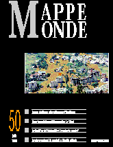

Editorial. Roger Brunet
Bertrand LÉVY. The First Regional Maps of Lake Geneva. (3 fig.)
Regional cartography has developed since the 16th century, with the «conquest of visible» as well as regional individualization stemming from biographical literature of the Renaissance. An image of the Lake Geneva region was formulated using early regional maps. Their representation codes, especially those of the humanist period of the end of 16th century, are presented in this paper.
Philippe LAHOUSSE, Pierre-Gil SALVADOR. Briançon, July 24, 1995: A Natural Catastrophe Autopsy and Lesson (5 fig.)
The rainstorms on July 24, 1995, in the Briançonnais region caused a series of torrential floods and disastrous debris flow. A cartographic approach combined with a historical survey enables us to measure the extent of this phenomenon and leads to a better evaluation of the dangers. It represents the necessary basis for a risk prevention policy.
Laurent GRISON. Voyage: Space and poetry in a calligramme by Apollinaire (1 fig.)
Apollinaire's work provides a precise approach to the concepts of poetry and space. Analysis of the calligramme entitled «Voyage», allows us to point out to what extent the author combines poetry and spatial analysis.
Roger BRUNET . Where is the Centre of the World? (3 fig.)
Depending on your point of view, the centre of the world doesn't exist or there exists an infinite number. However, the most central point can be calculated using either above water land surfaces or world population statistics. Several calculation methods are compared in this paper. The obtained points range from Chad to Ganges by way of Qatar.
Guy BAUDELLE. Spatial organisation of the Nord-Pas-de-Calais Region (6 fig.)
Nord-Pas-de-Calais is first of all a land of North-South contact between different environments, landscapes and civilisations. This location explains its main structuring patterns. Its density and urbanisation are exceptional compared with the rest of France. Its manufacturing industry still explains to a large extent the present dynamics.
Jean-Charles CLANET. Between Unity and Division: Spatial Organisation Dynamics in Chad (2 fig.)
Chad's spatial organisation opposes different kinds of human dynamics and strategies, whose old and established networks deal with the recent dryness. Model analysis highlights the territorial stakes in the transformation of Chadian space.
Franck DOLIQUE. Evolution of the coastline near Cayeux (France) (8 fig.)
Old postcards are used to support hypotheses concerning the recent coastal accumulation sector of successive cords, which are linked to variations of the Somme Bay's South channel.
Book reviews. Roger Brunet, Robert Ferras, Cécile Gaudin, Laurent Grison, Sylvie Lardon, Pierre Usselmann.
Mappemonde 1/98![]()
![]() Mappemonde 3/98
Mappemonde 3/98
Last modified: June 3, 1998